We will endeavor to provide you with the most current road conditions and access information for our community.
***Snow Conditions and Road Updates will be posted on the site blog. ***
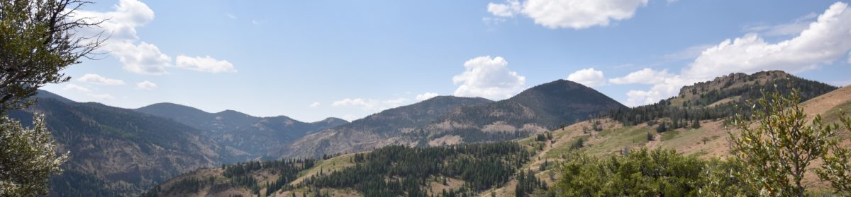
**Road Conditions – Thursday, April 8th, 2021**
At this time the only recommended access to Jarbidge is via Rogerson, ID
Please be aware as spring thaw has begun we are experincing some rock slides on the road between Murphy Hot Springs and Jarbidge. Please use due caution and be on the alert for falling and fallen rocks on the road.
As of this writing the route via Charleston will not be open until the end of June. At last check the route via Gold Creek/The Diamond A is not yet accessible.
HISTORICAL ROAD CONDITION POSTS BELOW
**Road Conditions – Saturday, November 27th, 2018**
As of today the route into Jarbidge via Charleston is closed for the season. The Gold Creek/Diamond A route is still open but be prepared for winter backroad driving conditions. The route via Jackpot/Rogerson/Murphys is open.
**Road Conditions – Saturday, November 24th, 2018**
We had a steady rain most of the evening in town Friday, November 23rd, 2018 which turned to snow during the night. We do not have any reports of how much snow fell in the meadows. If you plan on coming into Jarbidge via the Charleston, Gold Creek/Diamond A, or via Rogerson please be prepared for back-country winter conditions.
**7-Day US National Weather Service Forecast as of Wednesday, 11/21/2018@10:06 AM PST**
Per the US National Weather Service, unsettled weather is coming in for the Thanksgiving weekend. We have seen varying reports that indicate the higher elevations around Jarbidge could see as much as 12″ to 18″ of snow.
If you plan on traveling in the backcountry this holiday weekend please do so with caution and be prepared for adverse conditions.
Here is the link to the forecast as of 10:06 AM PST
National Weather Service 7 Day Forecast
**Road Conditions as of Monday, November 19th, 2018**
Courtesy of Jason Stegall, owner of the Red Dog Saloon & Outdoor Inn. Road conditions are good via both Charleston and the Gold Creek/Diamond A for access to Jarbidge at this time. Hunters in over the weekend advised there was a light dusting at the higher elevations but nothing that interferes with travel into Jarbidge. There is still time to come visit before the snow flies. The Red Dog Saloon is open and the Outdoor Inn has rooms available for rent.
**Road Conditions as of Wednesday, October 24th, 2018**
The road from Rogerson via Murphys Hotsprings to Jarbidge is in generally good repair and open with no issues.
**UPDATE USFS RESCINDED FOREST CLOSURE AS OF 09/12/2018 **
U.S. Forest Service Rescinds South Sugarloaf Fire Closure
After the initial assessments of the South Sugarloaf Fire Burn Area Emergency Response Team (BAER), the Humboldt-Toiyabe National Forest has reopened all of the closed area on the Mountain City-Ruby Mountains-Jarbidge Ranger District today.
“I want to thank the public for being patient with us as we dealt with the South Sugarloaf Fire,” said Josh Nicholes, District Ranger for the Mountain City-Ruby Mountains-Jarbidge Ranger District. “Although the BAER Team has been addressing safety concerns, I can’t stress how important it is for recreationists, hunters, and local residents to remain vigilant about safety hazards if they are in the fire’s burned area.”
According to Nicholes, wildfires dramatically alter the terrain and ground conditions, so people who are out hunting, horseback riding, or walking in the South Sugarloaf Fire’s burned area need to keep the following hazards in mind:
• Ash and needles on trails and footpaths can make for slippery conditions.
• Burned-out stump holes make the general forest floor weak and unstable.
• Unstable dead trees can be especially hazardous in windy conditions when they can fall suddenly.
• Loose rocks and logs can create rolling debris.
• Flash flooding and mud flows may be common in areas without vegetation.
He warned that the land, particularly the steep terrain, will be changing constantly and be unstable for many years until the vegetation becomes reestablished. “Even the most experienced Forest user will need to stay alert to their surroundings and changing weather conditions, and not take unnecessary risks,” said Nicholes.
Important safety precautions to keep in mind while recreating in an area recently burned in a wildfire include:
• Know Before You Go: Be aware of existing and impending weather conditions and check with the National Weather Service (http://www.weather.gov/) frequently for updates.
• Leave Detailed Trip Plans with a Trusted Person: The plan should include times and dates of departure and return. It should also include estimated arrival at certain checkpoints. Alert your trusted person if plans change.
• Do not Rely on Phones and Map Apps: There are many places on National Forest System lands where cellular services or coverage still DO NOT exist. A cell phone does not guarantee your safety. Have the appropriate navigation equipment and knowledge of how to use that equipment. Also, be aware in a burned area that trail and road signs may have been destroyed.
• High Wind Hazards: Pay attention to high wind advisories and high wind warnings issued by the National Weather Service. Take shelter immediately if there are high winds.
• Survey your surroundings: When camping check the contour of the land and look for potential trouble spots due to rain. Areas that could flood are extremely dangerous in a burned area. In addition, look for a camp site away from burned trees.
Nicholes also reminds the public fire danger remains extreme and that stage 1 fire restrictions are in place across the Mountain City-Ruby Mountains-Jarbidge Ranger District.
Stage I Fire Restrictions include:
• All campfires, charcoal grills, and stove fires (wood, charcoal, and coal burning) are only allowed in designated campgrounds/areas. Portable cooking stoves utilizing liquefied or bottled fuel sources continue to be allowed on public lands.
• Smoking is only allowed in an enclosed vehicle, building, or while stopped in an area at least three feet in diameter that is void of all flammable material, including vegetation.
• Use caution when operating or parking vehicles in close proximity to vegetation.
• No welding equipment may be used, including acetylene or open flame torches, except by permit.
• Fireworks, exploding targets, and incendiary or tracer ammo are always prohibited on public lands.
**UPDATE VOLUNTARY EVACUATION ORDER RESCINDED AS OF 08/29/218 @ 10:30 AM PDT**
**UPDATE 08/29/2018 @ 0930 AM PDT**
Erica Hupp, US Forest Service Public Affairs Staff Officer called at 9:30 AM PDT and advised that they are expecting to see the closure order for US Forest Service lands East of the Charleston/Bear Creek Road (County Roads 748 and 752) will be lifted as of Thursday, August 30th, 2018 at 08:00 AM PDT. This will include the Pine Creek and Sawmill Campgrounds as well as the Jarbidge Wilderness. The US Forest service will be posting a map sometime today that will show the areas that are going to be reopened. If your plans were to camp in Jarbidge and attend the great events planned for Labor Day please plan on keeping them! The US Forest Service is asking that the public to not enter US Forest Service areas West of the Charleston/Bear Creek Road (County Road 748/752) so as not to put themselves and the continuing firefighting operations in danger.
**Update as of 08/29/2018 at 6:51 PM PDT InciWeb is showing the S. Sugarloaf Fire as 83% contained. inciWeb- Incident Information System Show incidents
InciWeb The Incident Information System – S.Sugarloaf Fire Incident #6166
**Update as of 12:30 PDT 08/28/2018**
I apologize for the delay in posting. About 12:30 today maybe a little before I didn’t note the time. I received a call from the USFS Public Affairs Staff Officer, Erica Hupp. She did not have as many answers as I had hoped for but she is gathering information and will be staying in touch with me. What I can tell you is that currently the only access to Jarbidge is via the winter route through Rogerson, Idaho and that should be limited to residents and property owners. The access through Charleston and Gold Creek/Diamond A are closed for active firefighting operations. The past two days have provided good opportunity for the firefighters to make progress on fighting the South Sugarloaf Fire. The USFS primary concern is the safety of the public and the firefighting crews. There will be another incident command meeting later today and I should be hearing back from Erica at some point this evening or early tomorrow. As I receive information I will continue to post it via this site and I will also post the information on Facebook. I will be posting on Facebook first and then on visitjarbidge.org. Please feel free to contact me and I will share what I know. I would like to say that today has been a more typical day in Jarbidge. The sky is stunning Nevada Blue and the air is clear. We are deeply hopeful that this is a good sign!
**UPDATE 0900 08/29/2018
I spoke with a Forest Service information representative early this morning and she stated that at this time the only access to Jarbidge would be via the Rogerson, Idaho route. Both the Charleston and Gold Creek/Diamond A routes are closed due to active firefighting activities. I am currently awaiting a return call from the Elko US Forest Service Office with the most current information. I will be posting what information I receive from official sources such as the US Forest Service and the Elko County Sheriff’s Office here and on Facebook in the Jarbidge Community Association, Inc. Facebook page.
The below information is a direct cut-and-paste from the US Forest Service page:
Forest Service Expands Area Closure in Advance of the Growing South Sugarloaf Fire
Release Date: Aug 26, 2018
Contact(s): Erica Hupp (775) 355-5311; Naaman Horn (702) 515-5413
Elko, NV., Aug. 26, 2018 – Due extreme fire behavior and the continued growth of the South Sugarloaf Fire, the Humboldt-Toiyabe National Forest closed 754,448 acres on the Mountain City-Ruby Mountains-Jarbidge Ranger District. The new area closure, which goes into effect today, closes additional areas to the public that are not safe to enter due to the active fire behavior and fire suppression activities.
The entire area formerly known as Mountain City and Jarbidge Ranger Districts are closed for public safety. This includes all campgrounds, roads, trailheads, and trails are closed west of Forest Road 753 (Oneil Basin area), north of U.S. Interstate 80, and east of Elko County Road 785/Nevada State Route 226, and south of the Shoshone-Paiute Tribes of the Duck Valley Reservation boundary line.
Campground close are Jack Creek, Big Bend, Wildhorse Crossing, Pine Creek, and Sawmill Campgrounds. This closure also effects Nevada Department of Wildlife’s hunting areas 061, 062, 071, 072.
This closure will remain in effect until the Forest Service determines the area is again safe for the public. People who are found guilty of violating this closure order could receive a maximum fine of $5,000 or six months in jail or both.
The signed closure order is posted on the Forest’s website at https://www.fs.usda.gov/alerts/htnf/alerts-notices. For information on the South Sugarloaf Fire, visit https://inciweb.nwcg.gov/incident/6166/.”